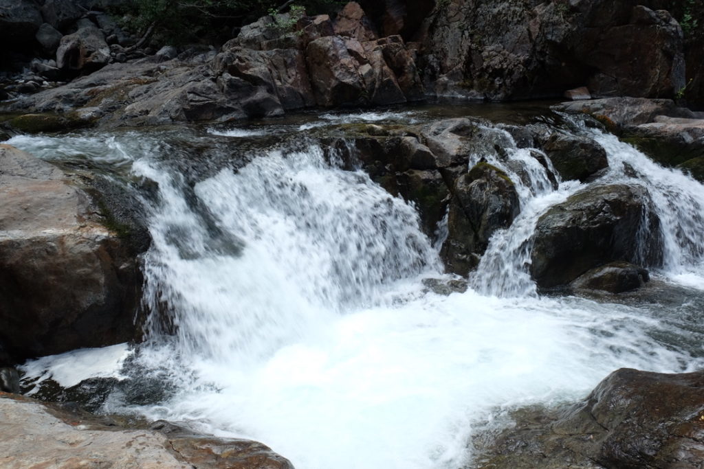
Pauley Creek is a wonderful creek that feeds into the Downie River. You’ll find Pauley Creek just at the edge of Downieville after it has cascaded down the rough terrain following much of the same path as the groups of high intensity mountain bikers on their downhill runs from Packer Saddle, 5000 feet above.
If you are walking on the mountain biking trails, keep an eye open for the mountain bikers. They will be coming down at top speed and may not expect to find you. In some cases the trail is really narrow and my have a steep drop off on the downhill side.
The creek can be accessed off of the First Divide and Second Divide trails. Access is tough. If you make the effort, you’ll find unmolested (small) fish that are very willing to take a well presented dry fly. Bring lunch, some water, and a buddy. Pauley Creek, near Butcher Ranch Creek. A hikers’ paradise, where you’ll find beautifully marked wild rainbows. Second Divide, where it turns to the south again and flows roughly parallel to Lavezzola Creek. The lower canyon is rather different to Lavezzola’s, being a little drier, its slopes cloaked in oak and manzanita, as well as in fir trees, and its pools deep and steep-sided. The rainbows that inhabit the lower canyon are silvery like those of Lavezzola Creek, while up toward Butcher Ranch Creek they have brownish backs and a narrow, deep-red stripe with a tint of gold above and below it, reflecting the change in their surroundings. The lower reaches are often sunlit, and the rocks are a pale gray, while upstream, alders and maples grow close over the westward-flowing stream, keeping it shady for much of the day. Ferns and Indian rhubarb line the banks of long pools and shallow runs among the brown, irregular boulders. These rocks carry an amazing variety of insect life, but as with Lavezzola Creek, the fly pattern you fish seems fairly unimportant. The premium is on predicting where the fish might be and making an accurate cast, the first one always giving you the best chance of success.
The first access is just across Hospital Bridge, where a trail goes to Pauley Falls, just behind the PG&E substation. From there, you can also hike the new First Divide Trail, completed in 1997, which runs high above the creek to join an old miners’ road that starts at the First Divide, opposite the chain-link fence. From both trail and road, faint trails lead down to the creek. If you drive Lavezzola Lane for 2.4 miles, you’ll come to the Second Divide Trailhead. Park there and hike the trail for just over a mile to a Y junction. If you stay right at the junction, the trail drops downhill a third of a mile to an old miner’s cabin, with good water upstream and downstream. Some minor rock climbing may prove necessary through here. If you stay left, the trail gradually drops closer to the stream at various points as it approaches the Third Divide Trail, but that is 4 miles from the trailhead. You could reach that point a littlequicker on the Third Divide Trail itself, just over 2 miles from the trailhead, or from Butcher Ranch Creek, the shortest hike, but also the steepest. Finally, Gold Valley can be reached by driving the dirt road beyond the Butcher Ranch off- highway vehicle trail 3.4 miles to a designated OHV trail on the left, signposted “Gold Valley 1.5 miles.