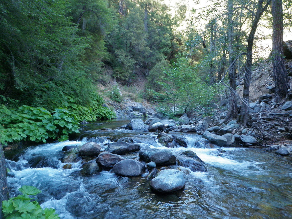
Lavezolla Creek has cold, clear mountain water, and lots of hungry rainbow trout. This is dry fly territory. Walking here is tough but worth it. You’ll find beauty, solitude, and eager fish.
Lavezolla was designated a ‘Wild Trout Stream’ by the state. It’s a gem and needs your respect. Visit it, enjoy it, and leave it the way you found it so you and yours can return again and again and keep finding joy in what it is offering.
This is 2 wt rod territory.
Lavezzola Creek is just as pretty as Pauley Creek, but interestingly different. Its deep canyon is initially separated from Pauley Creek by a narrow, forested ridge interrupted by gaps called “Divides” that carry the dirt road that winds upstream to Lavezzola Ranch and that give us our landmarks. Almost unique among small Sierra streams, it’s designated as part of the Wild Trout Program. The headwaters of Lavezzola Creek are a long way from any road, though a trail does follow it. The middle section can be reached by a short hike, and you can even park at the bridge at the Second Divide and fish right there. You’ll recognize this spot from the cover of a couple of issues of California Fly Fishing- it’s that picturesque.
The rainbows that inhabit Lavezzola Creek are silvery fish, with a faint lavender-pink stripe, effective camouflage in their brilliant environment. Its pools may be shaded by overhanging dogwoods, maples, or Indian rhubarb, but they’re illuminated by reflected light that bounces off the silvery-gray slate, pale sand, and golden-tan and green cobbles. The water has a slight aquamarine tinge and the gleam of crystal. Occasionally you can see a trout, seemingly suspended in air, but mostly you’d swear there were none present. Then you make a cast, and a trout comes from nowhere, like a conjuring trick. It seems to materialize beneath the fly, as if coalescing from water into a fish.
Fly selection doesn’t seem very important, though strangely for such a clear stream, attractor dries like Royal Wolfs and Humpies seem to work slightly better than drab, imitative ones like the Adams. In the fall, however, the water gets cruelly cold, and the hatches contract to midges and more midges. Then you can spot fish holding in smooth runs and tailouts, and tiny dries or midge pupae will catch them.
To reach Lavezzola Creek, take Main Street north from Downieville to the new Hospital Bridge across the Downie River. The road bends left, then you take a fork right onto Lavezzola Lane, a good dirt road going uphill. In 1.5 miles, you’ll come to the First Divide, from which you can see into both Lavezzola and Pauley Creek canyons simultaneously.
There is a chain-link fence and gate on your left, and if you walk around that, an old miners’ road will take you upstream for about half a mile before it drops down to the creek. You can’t fish upstream very far before some rock climbing becomes necessary, but faint miners’ trails go downstream a long way on the south bank, then continue on the north bank. If you stay on the road for 1.3 miles, you’ll cross a bridge and can fish either upstream or downstream. The parking area for the Third Divide Trail is 0.7 miles from the bridge, while the trailhead is on Empire Ranch property, a quarter of a mile up the road. The trail crosses Lavezzola Creek on a sturdy footbridge, and you can fish upstream or downstream. If you stay on the county road uphill through the ranch property, you can park by a locked gate in a mile and hike the now private road as it drops back down through a large meadow to the creek. Be respectful of any land owners. The further they are from town, the less they seem to like seeing strangers.
